"Your dream home starts here"
Our Drone Survey Services provide accurate, efficient, and cost-effective aerial mapping solutions for various industries. Using advanced UAV (Unmanned Aerial Vehicle) technology, we capture high-resolution imagery and data for land surveying, construction monitoring, agriculture, and environmental analysis. With quick deployment and precise measurements, our drone surveys help clients make informed decisions while reducing field time and operational costs.
Key Applications
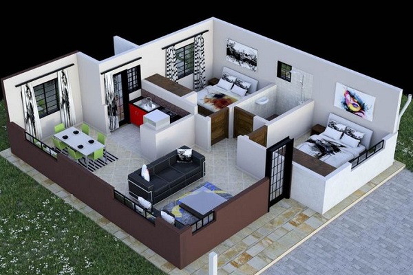
Our
architectural design services are tailored to meet the unique needs of each
project. We offer:
1. Land and Topographical Mapping: Create detailed 2D and 3D maps for urban planning, road construction, and property assessments.
2. Construction Progress Monitoring: Track project milestones with aerial updates and identify site issues early.
3. Agricultural Surveys: Monitor crop health, detect irrigation issues, and optimize farming practices using NDVI imaging.
4. Industrial Inspections: Conduct safe, non-contact inspections of towers, bridges, pipelines, and solar plants.
5. Environmental Analysis: Assess forest cover, water bodies, and land degradation with georeferenced aerial data.